July 2026 Newsletter

|
MONITOR
How Do We Know Which Waterways Need the Most Help?
Understanding Florida's Impaired Waterbodies
Have you ever wondered why “No Swimming” signs are posted along Phillippi Creek in Sarasota, or why people don't swim in the Manatee River upstream of the Braden River? The reason is simple: these waterways are among the 255 waterbody segments in Sarasota and Manatee counties that fail to meet Florida’s water quality standards for bacteria, making them unsafe for recreational contact. Every two years, the Florida Department of Environmental Protection (FDEP) assesses waterbodies and water segments (WBIDs) across the state. Their goal is to determine whether they are meeting water quality standards and designated uses established by state law.
When a waterbody does not meet those standards, it may be classified as impaired. Waterbodies at risk of failing to meet standards may be classified as threatened. These classifications help identify where more action is needed to protect and improve water quality. The process is part of the federal Clean Water Act, which requires states to submit their lists of impaired and threatened waters to the U.S. Environmental Protection Agency (EPA) every two years.
 FDEP's Map of Water Quality Assessments, Total Maximum Daily Loads (TMDLs), and
 FDEP uses all available data when assessing water quality. That is where Suncoast Waterkeeper comes in!
Every week, our team collects water samples at 19 recreational bayside sites along the Suncoast. We test for enterococci, a fecal indicator bacteria that can pose a public health risk to people in the water.
All of our enterococci data is input into the FDEP’s Watershed Information Network (WIN), the state's official database for surface and groundwater quality data. When FDEP conducts its biannual assessments, our data is considered alongside information collected by government agencies, researchers, and organizations like ours.
We also share our results with you on Instagram, Facebook, and our website, so you can make informed decisions about where and when to enjoy our waters. Additionally, our data serves another important purpose by helping government agencies better understand the health of our waterways.
When we collect a sample, we're not just answering the question, "Is it safe to swim here this week?" We're also providing important information to the agencies responsible for protecting public health and our waterways. By consistently monitoring sites where people spend time on the water and sharing that data, we help build a larger picture of changing water quality across the Suncoast. The more we know, the better we can identify problems, focus resources, and work together toward cleaner, healthier waters.
Learn more about waterbody classifications and the assessment process HERE.
INFORM
Last Remaining Old-Growth Wetlands Threatened by Permit Application
Walking in an old-growth mangrove forest with trees spanning over 19 inches in diameter and reaching over 30 feet in height sounds unimaginable, but that is the kind of system that has thrived off El Conquistador Parkway in Bradenton for as long as anyone can remember. Forests like this take centuries to form, and Florida doesn’t have many left.
 Old-growth mangrove forest in Manatee County
Now it is at risk, threatened by expanding development.
The developers behind Longbar Pointe’s “Sea Spray" are seeking approval from the United States Army Corps of Engineers to construct an 8- to 10-foot-high gabion wall (a wall made of large rocks inside wire cages) along the edge of these old-growth mangrove forests.
The permit application tells one story, claiming that the wall would reduce the need for extensive fill slopes and avoid impacts to nearby high-quality mangrove wetlands. However, the reality on the ground appears very different.
The Buffer Problem
Recognizing the important functions of coastal mangroves, local governments throughout Florida commonly require substantial buffers adjacent to these wetlands. In Manatee County, for example, the Land Development Code still requires a 50-foot buffer adjacent to coastal mangrove forests (even though the Comprehensive Plan has not been fixed since the hostile takeover in 2023). The purpose of these buffers is to prevent secondary impacts (or indirect, but still very real injury) from nearby development, including altered hydrology, erosion, sedimentation, stormwater runoff, noise, light intrusion, and changes in habitat conditions.
Rather than maintaining a true 50-foot vegetated buffer between development and wetlands, the largest portion of the project provides only 15 feet of separation between the development footprint and the mangrove system. As for the proposed gabion wall, plans place it immediately adjacent to the wetland edge along the buffer perimeter. A constructed wall is not equivalent to an undisturbed vegetated buffer regardless of its type; the purpose for the wall is the same.
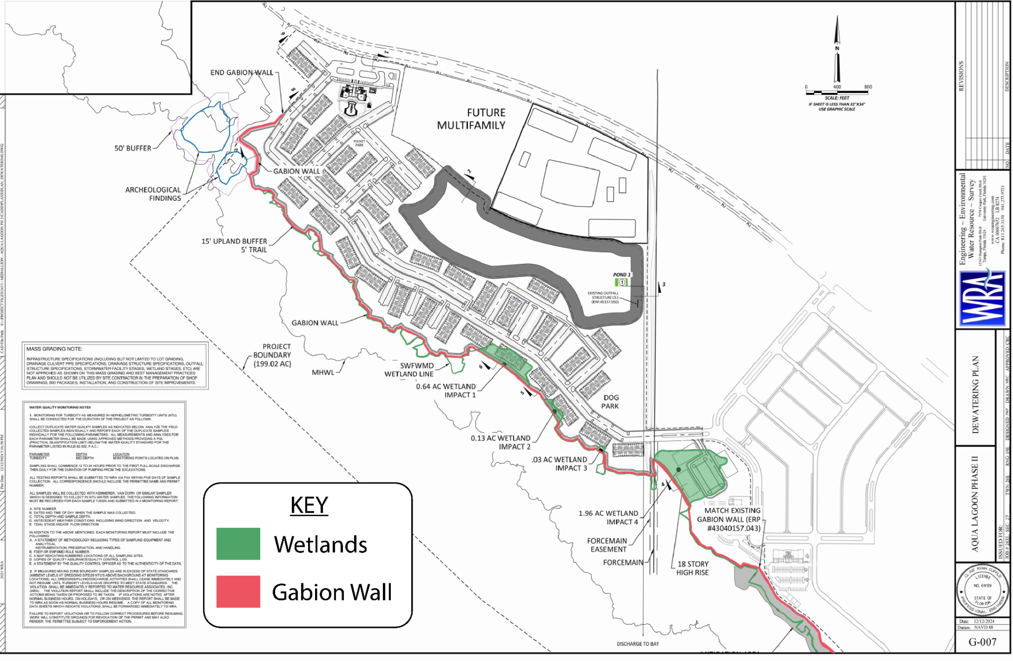 Proposed gabion wall at Longbar Pointe's "Sea Spray" development
Scientific studies have repeatedly demonstrated that development within wetland buffer zones reduces their protective functions and can diminish overall wetland health. A buffer is not simply vacant land; it is an ecological transition zone that protects the wetland from disturbances originating outside the wetland itself. Replacing a vegetated buffer with a hardened structure defeats many of the ecological purposes that the buffer was intended to serve.
Why “Environmentally Friendly” Walls Are Still a Poor Substitute
Gabion walls are often promoted as environmentally friendly because they are more permeable than traditional concrete seawalls. However, research demonstrates that gabion structures can significantly alter shoreline behavior.
Even partially reflected waves can create scour holes at the base. Sediment removed from these areas must be deposited elsewhere, potentially smothering adjacent seagrass beds or altering nearby shallow-water habitats.
The greatest impacts often occur not directly behind the wall, but immediately next to it. Shoreline stabilization structures frequently redirect erosive forces at their ends, accelerating erosion and altering hydrologic conditions along neighboring shorelines.
Mangroves Depend on Hydrology
Perhaps the most significant concern is the effect of the wall on mangrove hydrology.
Mangroves are highly sensitive to changes in water depth, flooding frequency, flooding duration, sediment movement, and tidal exchange. Research conducted in Tampa Bay found that altered hydrology is one of the earliest and most significant indicators of stress in mangrove ecosystems.
According to Radabaugh et al. (2021), changes to a mangrove system's hydrology can shift water depth, how long and how often flooding occurs, how sediment builds up, and how nutrients move through the system. All this can occur before the trees themselves show any outward signs of stress.
Mangroves can handle natural, gradual changes in their environment. What they can't handle as well is a sudden shift imposed by nearby construction. The introduction of a gabion wall just 15 feet from an old-growth mangrove system raises a real question: how will it change the water and sediment patterns these ancient trees have relied on for generations?
No Demonstration of Long-Term Permeability
A central argument in favor of gabion walls is that they allow water to pass through the structure. However, permeability is not a fixed characteristic. Over time, the gaps in a gabion wall tend to fill in with sand, fine sediment, decaying plant matter, floating debris, and material washed in during storms. As that happens, the wall starts behaving less like a permeable barrier and more like a solid seawall, bouncing back more wave energy and making erosion and scouring worse.
The available permit materials do not appear to include a site-specific permeability analysis demonstrating how the proposed wall would function under local tidal, sediment, and storm conditions. Without such analysis, there is little basis for concluding that the wall will maintain adequate water exchange.
“Coastal Squeeze”, Future Wetland Loss and Protecting What Remains
As sea levels rise, mangrove forests naturally migrate landward. When a vertical structure is placed immediately next to a wetland, that migration pathway is blocked. The result is that the wetland becomes trapped between rising water levels and a fixed barrier. Research in Nature identifies this "coastal squeeze" as one of the biggest long-term threats to coastal wetlands. This way, a structure doesn't need to remove a single tree to cause serious wetland loss.
The mangrove forests adjacent to this project are not degraded remnants. They are high-quality coastal wetlands that provide ecological functions benefiting the entire region.
The question before regulators is not simply whether a wall can be constructed without directly filling wetlands. The question is whether placing a large engineered structure within what should serve as a protective buffer will create secondary impacts that gradually degrade the wetland and therefore are not within the public interest.
The available scientific literature suggests that such risks are real. Altered hydrology, disrupted sediment flow, shoreline scour, reduced potential for wetland migration, and changes in habitat conditions are well-documented consequences of hardening a shoreline.
For a wetland system that has likely taken centuries to develop, the burden should be on the applicant to demonstrate through rigorous scientific analysis that these impacts will not occur. Until that burden is met, approving development so close to a high-quality mangrove forest risks undermining one of the most valuable coastal resources remaining on Florida Suncoast.
How You Can Help
The U.S. Army Corps of Engineers is accepting public comments on this permit application (Permit Application SAJ-2015-015030) through August 7, 2026.
You can submit a comment:
-
Online through the USACE Regulatory Request System
-
By email to [email protected]
-
By mail to: U.S. Army Corps of Engineers, Jacksonville District Attn: Edgar W. Garcia, Senior Project Manager 10117 Princess Palm Avenue, Suite 120 Tampa, FL 33610
All comments become part of the public record and are considered by the Corps in deciding whether to issue, modify, condition, or deny the permit.
|
Thank you for lending your voice to protect healthy mangrove wetlands, clean water, and fisheries habitat while demanding responsible coastal development. Now is the time to make your voice heard!
ACT
Don't Just Watch the Tide. Turn it.
We are excited to launch The Tide Turners, our brand-new monthly membership community dedicated to protecting our local waterways.
For just $25 a month (83¢ a day), you move from a passive observer to an active agent of change. Your predictable monthly support provides the baseline force Suncoast Waterkeeper needs to monitor water quality, pursue responsible legal action, and empower the local community to defend our environment. Together, we can ensure the Suncoast has swimmable, drinkable, and fishable water for ALL.
Exclusive Membership Benefits Include:
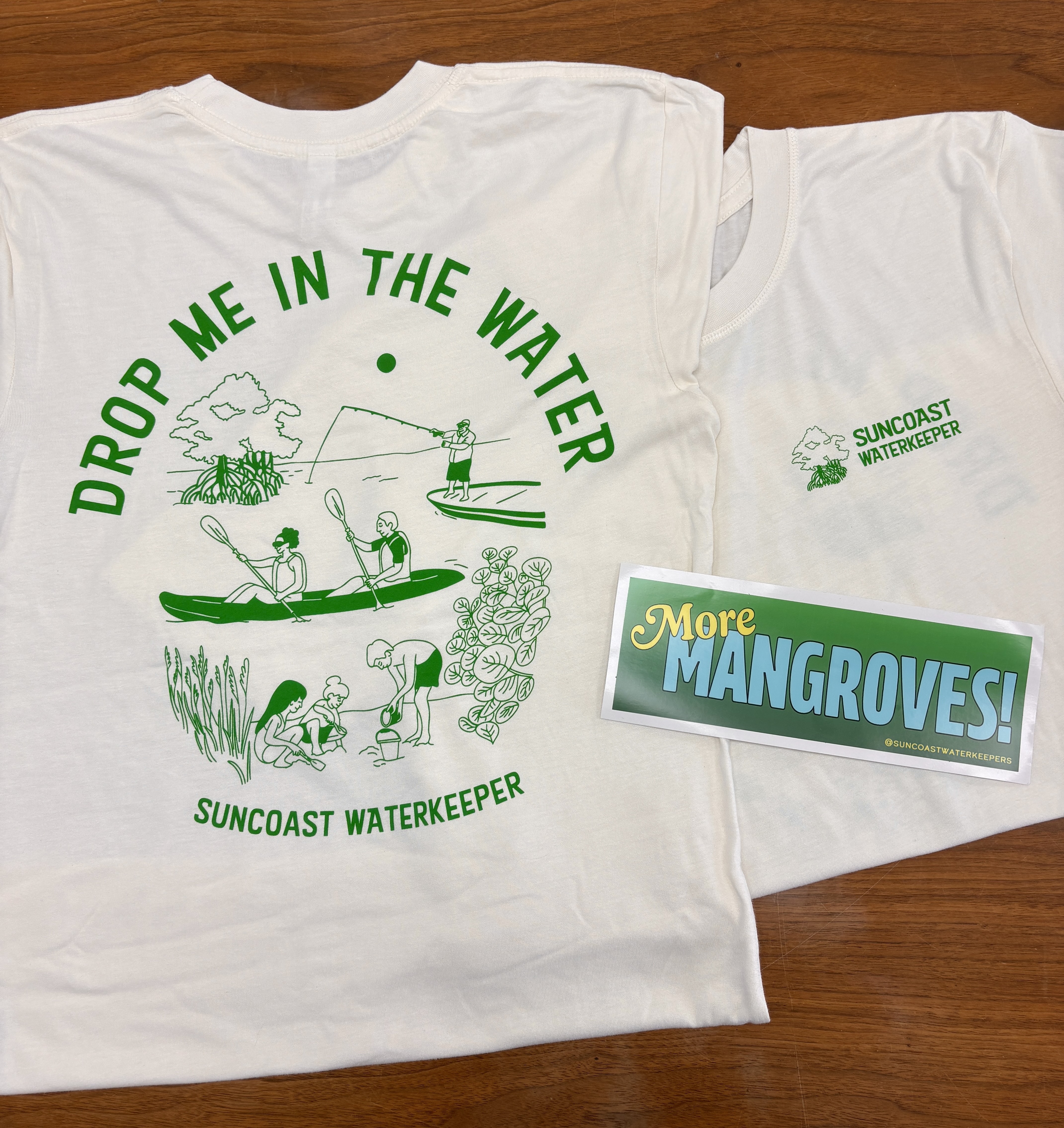
- The Tide Turner Kit: Get an exclusive bumper sticker and newly designed Suncoast Waterkeeper T-shirt to wear out on the water.

- VIP Event Access: Secure your invitation to premium community events, including our September Paddle & Picnic. Sign up before August 29 for early entry to the private Tide Turner Pre-Party an hour before our annual member meeting.
|
Join Us for Our Annual Members Meeting on August 29!

We are thrilled to announce that Suncoast Waterkeeper’s Annual Members Meeting will be held on August 29, 2026, at the Bay Park Conservancy. The evening will include updates from our team on the results of our water quality and ecosystem monitoring programs and how we are using that information to inform others and take action to protect the Suncoast. All of our work is made possible by our members. The Annual Meeting is a time to connect with fellow clean-water champions! After the meeting, we will lead a moonlight paddle.
|
NOTE: If you registered for this event in the spring, please kindly re-register to let us know you are still interested in attending!
For a Full Listing of Our Events and Ways to Act, Visit Our Events Page.
To get involved, send an email to [email protected]
Like we are doing? Join our clean water mission!
https://www.suncoastwaterkeeper.org/
Author